Consumer Drone Mapping
Flight Parameters: Overlap, Altitude & Speed for Mini Mapping
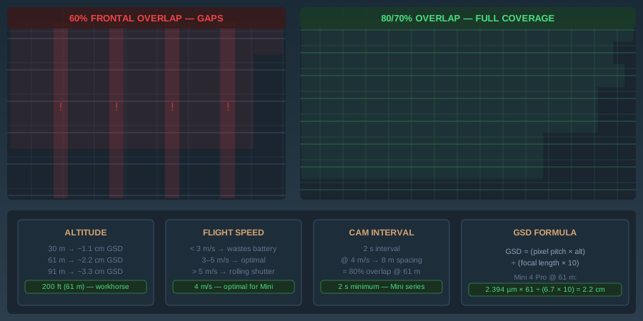
Drone mapping flight parameters: GSD, overlap, altitude, speed. 80% frontal / 70% side minimums. Accuracy improves 11x from 60% to 80% overlap.
Read more →


Tag Archive
3 articles on Mini 4 Pro. Field-tested methodology from a GIS scientist with M.S. GIS, FAA Part 107, and 10+ years of geospatial work.
Drone mapping flight parameters: GSD, overlap, altitude, speed. 80% frontal / 70% side minimums. Accuracy improves 11x from 60% to 80% overlap.
Fly a grid mission with a consumer drone, process a georeferenced orthomosaic in WebODM within 90 minutes. No GCPs, no survey gear, no paid software.
WebODM (free) vs Pix4D ($399/mo) for consumer drone mapping: real cost math, WebODM Lightning pricing, orthomosaic quality, and when each is worth it in 2026.
Free download: The Complete Drone Mapping Workflow Guide — 30+ pages of field-tested methodology.
Technical content only. Unsubscribe anytime.